
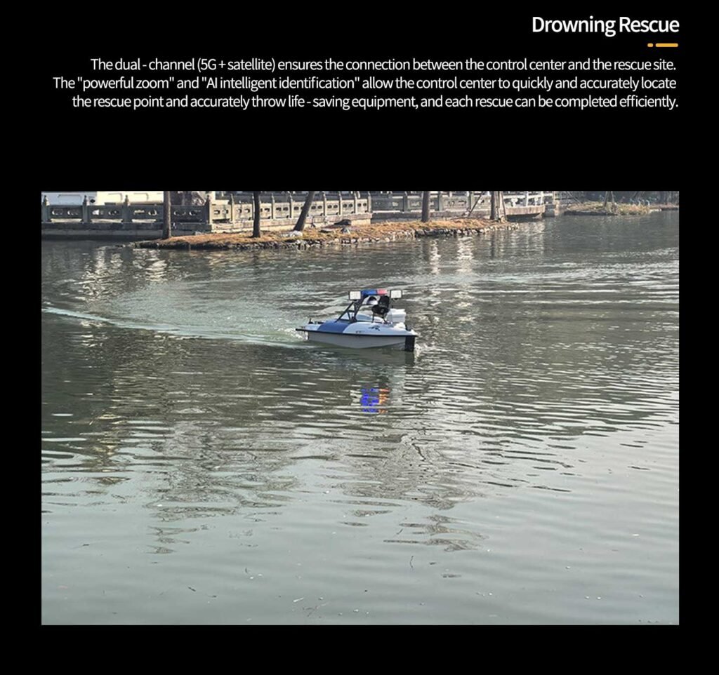
In critical security scenarios such as port terminals, border coastlines, and inland water areas within cities, traditional manual patrols are limited by factors like manpower, efficiency, and environmental conditions, making it difficult to achieve comprehensive and all-weather precise control. The launch of the Haixiaolou ZR20 surface reconnaissance unmanned vessel, with its core capabilities of “autonomous navigation, intelligent identification, and remote linkage”, has become a “mobile telescope” for water area reconnaissance, establishing an efficient and intelligent security barrier for various water area scenarios.
Core Advantage: Designed specifically for waterborne reconnaissance
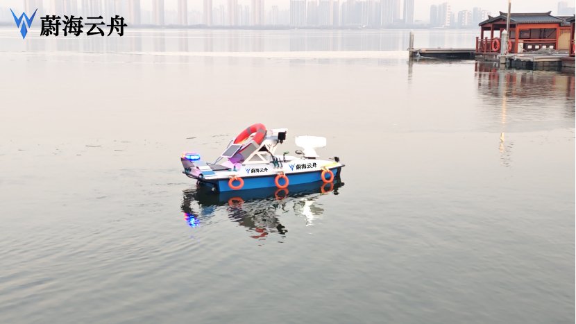
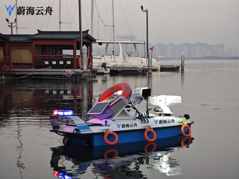
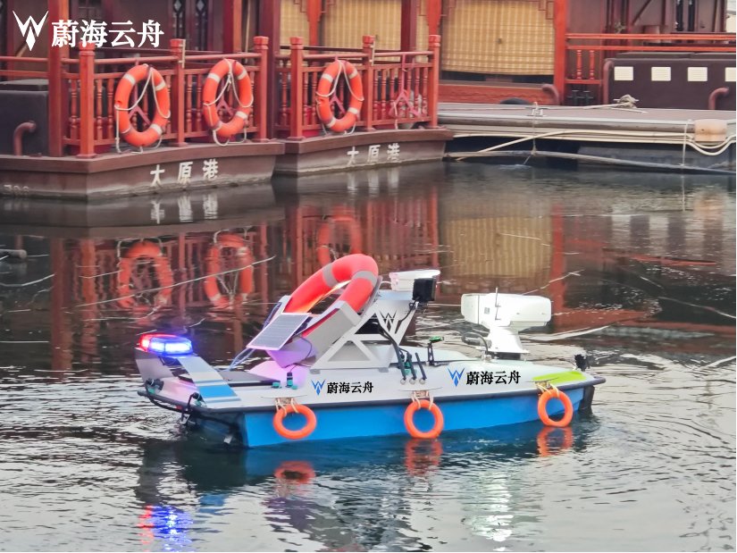
The Haixiaolou ZR20 is a specialized unmanned vessel dedicated to water patrol, illegal evidence collection, and emergency response. Its core value lies in the deep integration of “multi-source sensing + intelligent control + remote linkage”. As a mobile reconnaissance platform, the unmanned vessel is equipped with high-definition cameras, audio and visual warnings, etc., and can autonomously complete tasks such as target recognition, image evidence collection, and real-time warning in water areas, meeting the security needs of various scenarios including urban rivers, ports, and scenic areas.
Starting from the investigation requirements, we have achieved specific breakthroughs in three major dimensions: ship body design, perception system, and intelligent control, to fully adapt to the investigation tasks in complex waters.
The highly maneuverable ship body, suitable for all-water area investigations, adopts a lightweight carbon fiber hull, weighing only 45KG, allowing one person to complete the transportation and deployment. The draft depth is only 20cm, enabling it to flexibly navigate through areas such as shallow beaches, inland river tributaries, and hidden canals in ports that traditional patrol ships cannot reach. Equipped with a dual-motor propulsion system, the maximum speed can reach 8 knots, the cruising speed is 4 knots, the endurance time is up to 8 hours, and the single endurance range covers more than 20 kilometers, meeting the regular investigation needs in large areas of water.
Multi-sensor fusion enables all-weather perception. The onboard investigation system adopts a multi-source perception scheme of “high-definition optical-electrical pod + radar warning”. Through a 1080P high-definition camera, it can achieve target recognition and detailed capture within a 500-meter range. The intelligent recognition algorithm improves the accuracy of investigation. An AI target recognition module is built-in, trained on a large number of water area scene samples, and can automatically distinguish “legally operating vessels, illegal intrusion targets, floating obstacles” among the three types of targets. It focuses on identifying suspicious behaviors such as unlicensed vessels, border-crossing navigation, and illegal docking, with an identification accuracy rate of over 92%. After detecting a suspicious target, the system automatically marks the target position, takes photos for evidence collection, and simultaneously triggers an audible and visual alarm, warning and deterring the target.
Core Function: Full-process intelligent investigation operation
The design of the Ha Lookout R20 covers the entire process of “task planning – autonomous investigation – early warning and disposal – data retention”, significantly reducing the cost of manual intervention.
Autonomous navigation, achieving unmanned on-duty support. Through the shore-based control platform, preset the investigation route, the unmanned boat automatically cruises according to the planned trajectory, combined with GPS + dual-mode navigation of Beidou, the positioning accuracy reaches centimeter level, ensuring that the investigation trajectory is without deviation. At the same time, it has an automatic obstacle avoidance function. Through radar and visual sensors, it can perceive obstacles in real time and automatically adjust the course to avoid collisions, avoiding collision risks. When the battery power drops below 20%, it automatically starts the return program and precisely docks at the preset recovery point.
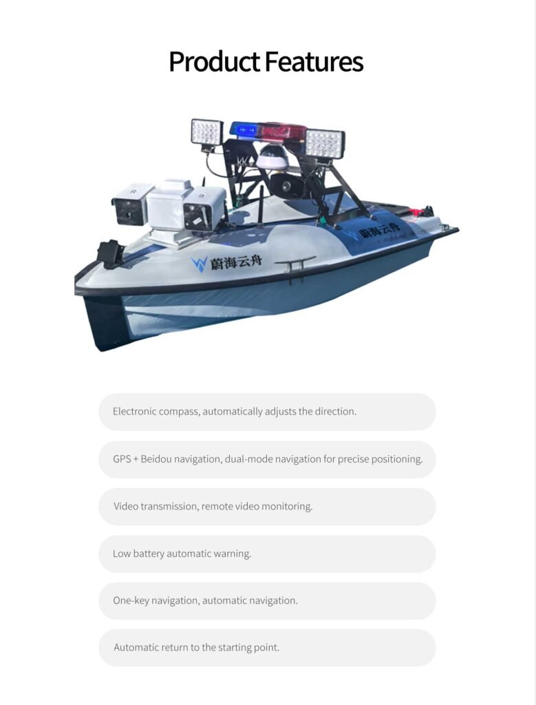
Remote linkage enhances emergency response efficiency Through the 4G/5G dual-mode communication module, the surveillance footage and target data can be transmitted in real time to the command center with a delay of less than 200ms. Staff can remotely control the unmanned boat to adjust the surveillance angle and track and capture suspicious targets. It supports multi-boat collaborative operations. After multiple unmanned boats form a network, they can achieve full coverage of the water area, forming an integrated linkage system of “surveillance – early warning – command”, reducing the emergency response time from the traditional “hour-level” to “minute-level”.
Data retention improves the legal evidence chain All investigation data (including real-time videos, target photos, navigation trajectories, identification records) are automatically stored on the local SD card and cloud server. It supports encrypted backup, and the data retention period is up to 3 months. The system can automatically generate the “Water Area Investigation Report”, including the number of targets, statistics of suspicious behaviors, and evidence materials, providing complete and effective evidence support for subsequent law enforcement work.
Typical application scenarios: Meeting the security needs of various water areas
Port and wharf security
Regular patrols are conducted in areas such as port anchorages, waterways, and hazardous goods terminals to identify unauthorized vessels approaching and illegal boarding of personnel, aiming to prevent security risks such as smuggling and theft.
Urban river management
Inspect illegal fishing and illegal sewage discharge at urban river waters, automatically capture evidence of violations, assist in environmental law enforcement; at the same time, monitor floating garbage on the water surface and the outbreak of blue-green algae, and promptly issue warnings of pollution risks.
Emergency rescue investigation
In the event of disasters such as floods and typhoons, quickly deploy to the affected waters, investigate the location of trapped personnel, assess the disaster situation, provide precise on-site data for rescue teams, and reduce the risk of personnel rescue.
Application Value: Promoting the Upgrade of Waterborne Investigation Models
The practical application of the Sea Observer R20 has completely transformed the traditional waterborne investigation model, which was characterized by “high labor intensity, low efficiency, and high risks”, and has achieved three value upgrades:
Cost Reduction and Efficiency Enhancement: A single person can control multiple unmanned boats, reducing labor costs by over 70% and increasing investigation efficiency by 5 times;
All-Weather Coverage: It fills the investigation blind spots in shallow areas, dark channels, etc., achieving “no blind spots” in waterborne security;
Safe and Controllable: Unmanned operation avoids the risks of personnel in adverse weather and dangerous waters, ensuring the safety of law enforcement officers.
From port terminals to border coasts, from urban inland rivers to emergency sites, waterborne investigation unmanned boats are reshaping the landscape of waterborne security. It is not only a vivid practice of technology empowering security, but also makes the vision of “24-hour uninterrupted protection” become a reality. In the future water governance, these “mobile eyes” will continuously release technological benefits, making every water area safer and smarter, and providing continuous technological impetus for building a safe water area and protecting the ecological homeland.